Author Topic: The PCT Volume 23: The More the Merrier  (Read 22434 times)

Brad Young

  • Grand Master
  • ***
  • Posts: 6683
The PCT Volume 23: The More the Merrier
« on: August 13, 2014, 11:52:11 AM »
This trip isn't quite done yet (we're hoping to start another three day segment in the Desolation Wilderness tomorrow), but I've got computer access on this, our rest day. So I thought I'd start a new trip report.

As we'd hoped might happen, we had excellent company for the first part of this week on the PCT. All three Dawsons joined us for a three day, mixed backpacking/dayhiking, 28.4 mile "highway to highway" leg from Ebbetts Pass to Carson Pass. J.C. and K.C. joined us for this leg too, although they weren't prepared to backpack, so they day-hiked and spent their non-hiking time hanging out with our shuttle driver "par excellence," Vicki.

We met early at Ebbetts and got set up to hike:


Vicki joined us for an easy first mile around Ebbett's Peak. The Cooks stayed with us for the first 3.5 miles before turning around to rejoin Vicki and then help with a three-car shuttle:


Naturally, John played geologist among all the northern Sierra volcanic formations:


Here's where the Cooks turned around:


This section of hiking is some of the easiest I've ever experienced in the Sierra. We went 10 miles exactly this first day and gained a cumulative total of maybe 400 feet in the first 8.5 miles. And the views on this part of the hike were excellent to the north, east and south:


As we took in the views, we broke into smiles when we came to "Son of Hummingbird Spire." This spire on the east side of Reynolds Peak looked exactly like the Pinnacles National Park formation Hummingbird Spire. I just had to take photos. Here's one of them:


(For some reason seeing this formation made me think immediately of Rob. Maybe because I think he'll ask me how far into the Wilderness it is?)

Steve saw the resemblance too:


We enjoyed lunch on Pennsylvania Creek:


We then came to a shoulder/summit on the Sierra Crest where the views were so fine we just had to stop:


Although the skies weren't very clear, we got our first views from here of the Highway 395/Garnerville/Minden area:


Here's a shot I liked. It's of me with my friend/climbing partner/fellow guidebook author of 20 years now:


We arrived at the Raymond Lake Trail junction, a location that was just stunningly beautiful:


And then, as planned, we diverted three quarters of a mile to Raymond Lake; this is a small lake nested in an obvious cirque. It looked like it would be a beautiful location to spend the night:


And it was. We arrived early enough to set up camp, to walk around the lake, to play "fetch" with the dogs in the water, to eat dinner and then to sit through a nice (nice when you're prepared for it) 15 minute rain shower:


We had wonderful evening light among the lasting clouds. This was a fitting end to a really nice day in the wilderness, one spent this time with good friends who'd come out specially to join us on our beloved PCT adventure:


Next up, we spend a viewful morning backpacking just far enough to meet Vicki and the Cooks (and to switch to very light day packs) on Blue Lakes Road.


mungeclimber

  • PermaBan
  • ***
  • Posts: 6665
    • http://www.sonorapassclimbing.com
Re: The PCT Volume 23: The More the Merrier
« Reply #1 on: August 13, 2014, 01:45:07 PM »
How far in is that boulder, and the Son of Hummingbird Spire? :)

On Aid at Pinns... It's all A1 til it crumbles. - Munge

Brad Young

  • Grand Master
  • ***
  • Posts: 6683
Re: The PCT Volume 23: The More the Merrier
« Reply #2 on: August 13, 2014, 02:51:27 PM »

How far in is that boulder, and the Son of Hummingbird Spire? :)


Nice  ;)

They are in about four and five miles respectively.

And having seen the photo, don't you think that spire look like Hummingbird?

mungeclimber

  • PermaBan
  • ***
  • Posts: 6665
    • http://www.sonorapassclimbing.com
Re: The PCT Volume 23: The More the Merrier
« Reply #3 on: August 13, 2014, 02:58:49 PM »
without question.

Lots of choss options! 

I was particularly interested in hiking to the stuff at Sonora Peak, just north of the Pass.
On Aid at Pinns... It's all A1 til it crumbles. - Munge

Brad Young

  • Grand Master
  • ***
  • Posts: 6683
Re: The PCT Volume 23: The More the Merrier
« Reply #4 on: August 13, 2014, 04:41:42 PM »
Raymond Lake gets early morning sun. We took advantage of it:


Then an easy hike led back to the PCT. And from there we switchbacked down and then moved across to a prominent trail saddle that we'd been looking at yesterday:


Notice in that last photo that nine year old Alex is in the lead? Although we didn't really intend or plan on it, Alex led our hike for most of this day. And I'm not talking about all of us taking baby steps either; he stepped it up and hauled buns. Not bad (for a boy that is ;D ):


On her behalf, Tricia is getting to be pretty damn good at navigating, reading a map, and finding her way in the out of doors. Here we are in a map study:


After five and a half pleasant miles we reached Sunset Lakes Road where Vicki and the Cooks were waiting. We stopped for snacks and water and to drop our big packs. The Cooks were now going to join us for the rest of the day:


Like her sister, Tricia seems to burn through lots of calories (it doesn't help that she's growing like a damn weed). And like her sister she tends to grab calories from weird places (like here, eating uncooked ramen noodles):


The next three miles were about as easy as hiking gets. We planned to meet Vicki for lunch at the next road crossing, so we carried nothing:


Our after-lunch hike started in forest. Pretty enough, but not very viewful. That then changed as we approached The Nipple. This formation is above tree line:


And the views were 360 degrees - we could see for miles and miles:


We walked along the entire length of The Nipple's east side. The view down to Upper Blue Lake was nearly vertical:


The traverse around the Nipple led to Lost Lakes. Although there is bandit camping at these lakes, the area is used heavily by RVs and the like. It was a little dusty and rocky for our taste. But when I suggested moving a mile away to Upper Blue Lakes Campground, Vicki thought maybe not. Apparently the 8/10 of a mile she'd just driven from that campground to meet us at Lost Lakes was "about the worst she'd ever driven." Naturally, I've been on some of the roads she's driven, and so her comment carried great weight with me (as in "holy shit! - that bad?").

But she had to drive back that way at some point. So we decided to go down the 8/10 mile now, stay at the public campground, but then walk back to the PCT in the morning instead of having Vicki shuttle us all back up to the trail.

The campground was very nice (mid-week). We had a pretty good sized group though and so we also had some chaos:


And remember Tricia's appetite? She eats a lot because she burns a lot of energy on these trips. The amount of energy she burns also means that she occasionally takes naps; wherever and whenever she happens to fall asleep:


F4?

  • unworthy
  • Posts: 6172
Re: The PCT Volume 23: The More the Merrier
« Reply #5 on: August 13, 2014, 07:26:33 PM »
Quote
Desolation Wilderness tomorrow

Odd, I heard is was "Distillation Wilderness".

Mungie, remember that one  from the REI days?

Ahh yes Blue Lakes. That is a wonderful place...good memories. We used to camp @ the upper lake.

There's a reason they lost them lakes (the roads used to be do-able in my old truck).
I'm not worthy.

Brad Young

  • Grand Master
  • ***
  • Posts: 6683
Re: The PCT Volume 23: The More the Merrier
« Reply #6 on: August 17, 2014, 10:01:14 AM »
Our third day was casual and fun; an easy hike in pretty terrain with good friends. We started from the campground up the road back to the trail. We immediately got sprinkles:


To this day Tricia carries on a tradition Katie started at the beginning of our hikes: calling out and trying to touch every PCT sign. But I outdid her on the first one this day:


Although the skies were dark, the views were excellent for the whole hike. Looking back at The Nipple:


Looking west to Summit City Canyon:


And east, down toward Hope Valley and the Highway89/Highway 88 junction:


We took shelter during a ten minute downpour (did breaking down and getting out our rain shells really make it stop?):


Laura used the rain to catch up to us:


After it cleared we moved around the east side of Elephant's Back. Here we got our first views of Highway 88 (it's a highway, and we're hiking, an activity designed to get away from roads, but we're also kinda trying to finish a long, long distance and passing known, identifiable geography is in that sense gratifying):


Here's a photo that I love. It shows two friends of mine, and it also includes a 12 year old daughter whose pose - just the pose - seems to tell me that she's having fun in the outdoors, that she's confident there and that the time and effort we've put in together on the PCT has been worth it and will be worth it to her 30 years from now:


It seemed too soon, but we arrived at Carson Pass before noon. It was time to split up and go our separate ways. But not before twenty extra feet of trail and a group photo:


And that was it for day number three. That afternoon we had three hours of pounding rain and hail (more than enough to make us glad we'd done a short hike and that we were off the trail).

Coming up: our fourth day, just the "T Girl" and I flying the trail from Carson Pass to Echo Summit and having a ball.


Brad Young

  • Grand Master
  • ***
  • Posts: 6683
Re: The PCT Volume 23: The More the Merrier
« Reply #7 on: August 17, 2014, 04:09:46 PM »
We woke up Tuesday to partially cloudy skies but a great weather prediction. We decided to go for it, just Tricia and I now, hoping and expecting that it wouldn't pound rain and hail like it had the afternoon before. After a nice breakfast, our very own "trail angel" dropped us off at Carson Pass:


This Carson Pass to Echo Summit part of the trail is about as easy as hiking can get for the first 10.5 out of 13.4 miles (after 10.5 it drops 1,500 feet of elevation, which is a little more difficult type of hiking). It also involves lots of very open terrain with great views:


We got our first PCT view of Lake Tahoe from about 15 miles away:


Our next view of the lake was even better:


One of the many volcanic formations we saw made me think of Clink (who did the FA of a Pinnacles National Park formation that looks just like it). I doubt he'll ask me how far into the wilderness this is  ;D


Tricia and I really flew this section of trail. We did 13.4 miles in five hours flat. That's not so surprising for a 53 year old, but my little 12 year old left me feeling pretty impressed on this hike. Just at 10.5 miles, right where the PCT loses 1,500 feet, we got a fantastic view of Lake Tahoe (right along Lake Tahoe Airport):


Before we knew it we were at the parking area for Echo Summit. Our shuttle driver (who happens to be the love of my life) met us there with lunch and a faithful dog (who'd been riding in the car today with sore paws):


A quick and easy hike leads from Echo Summit to Echo Lakes. Charlotte joined us for this one (on soft forest tread). Along the way we saw this gigantic (huge) fungus:


Highway 50 is pretty busy:


We reached Echo Lakes, the end of this day's segment (but started across the dam so as to insure overlap with the coming hike):


After this fourth day we had to take a rest day (a "zero day" in the language of PCT through hikers). We weren't necessarily tired. And the weather looked good for hiking the next day. We could have kept on. But we needed and really, really wanted to wait a day for a certain tough and gorgeous 18 year old who couldn't make it up to join us until Thursday, two days hence...

clink

  • Meanderthal
  • ****
  • Posts: 4011
Re: The PCT Volume 23: The More the Merrier
« Reply #8 on: August 17, 2014, 08:57:32 PM »
You guys are inspiring! How many more miles are planned for this year?
Causing trouble when not climbing.

mungeclimber

  • PermaBan
  • ***
  • Posts: 6665
    • http://www.sonorapassclimbing.com
Re: The PCT Volume 23: The More the Merrier
« Reply #9 on: August 17, 2014, 10:25:08 PM »
Quote
One of the many volcanic formations we saw made me think of Clink (who did the FA of a Pinnacles National Park formation that looks just like it). I doubt he'll ask me how far into the wilderness this is  Grin

He should!
On Aid at Pinns... It's all A1 til it crumbles. - Munge

Brad Young

  • Grand Master
  • ***
  • Posts: 6683
Re: The PCT Volume 23: The More the Merrier
« Reply #10 on: August 18, 2014, 06:04:40 AM »

You guys are inspiring! How many more miles are planned for this year?


If it works out, we're planning to go just over 32 more miles, from Barker Pass to Highway 80. This is planned for September 6 and 7. That would put us at around 212 miles for 2014.

And how's this for perspective: if we keep up this pace we'll pass the PCT's halfway point about 2/3 of the way through next summer. Halfway!

Brad Young

  • Grand Master
  • ***
  • Posts: 6683
Re: The PCT Volume 23: The More the Merrier
« Reply #11 on: August 18, 2014, 07:20:32 AM »
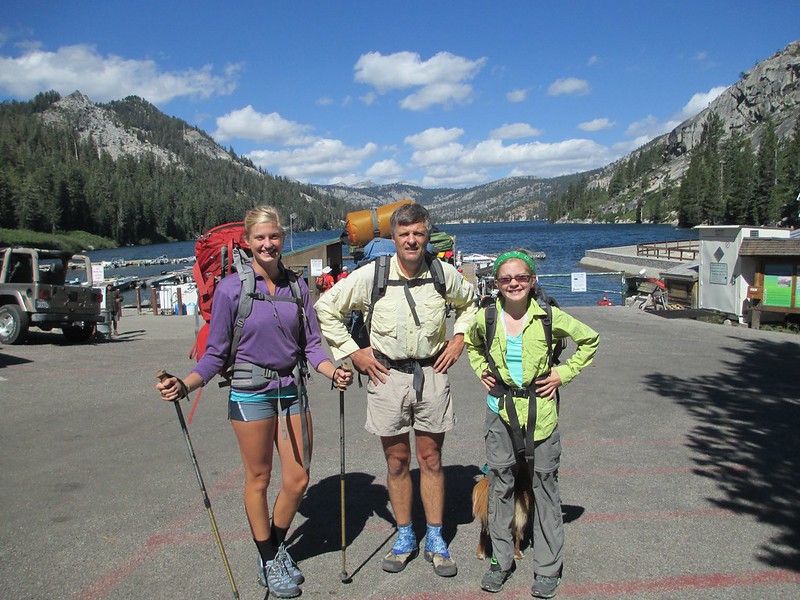
The last leg of this trip was a three day, 32.3 mile backpack through the Desolation Wilderness. And the treat on this trip was Katie; it was to be three of us for this trip yet again. And oh what a blast we had.

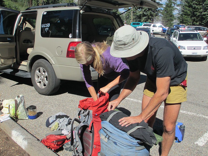
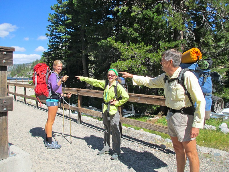
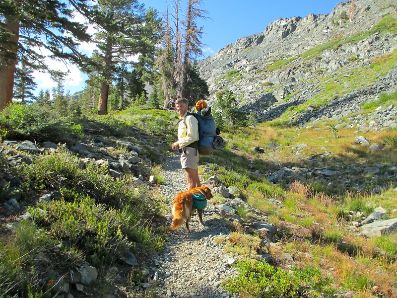
We packed and got ready at Echo Lakes:


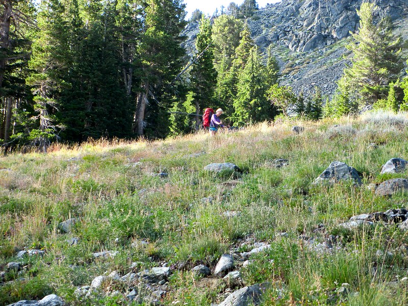
We had some confusion over which way we should go   ;)


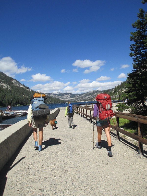
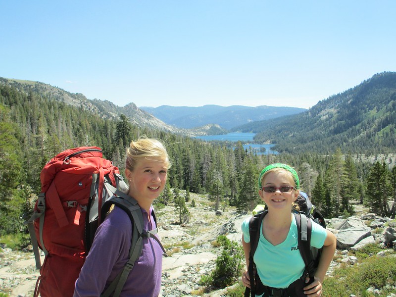
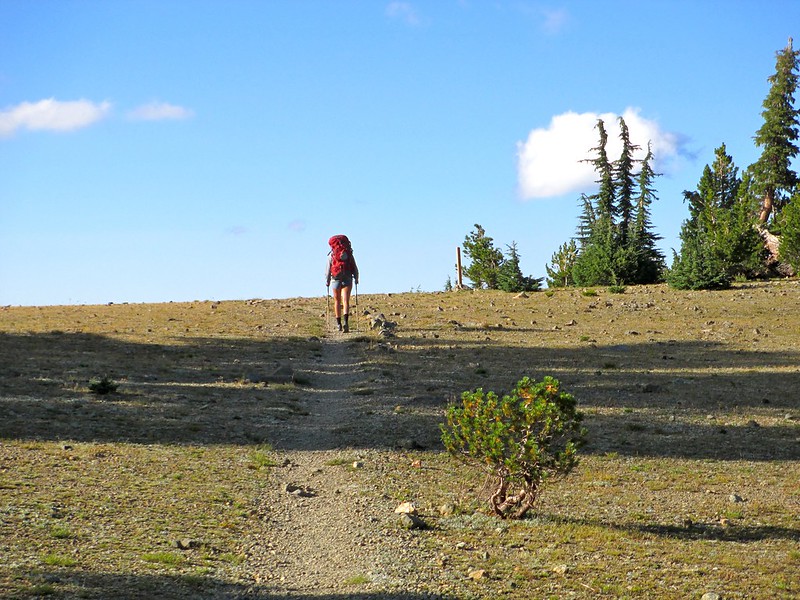
And then we got going up an easy if extremely crowded trail (I'd heard the Desolation Wilderness is crowded, but holy wow! Tricia counted 188 other hikers in 15.2 miles on our first day):


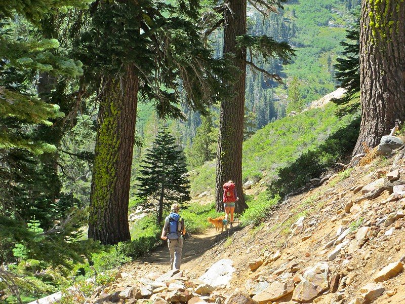
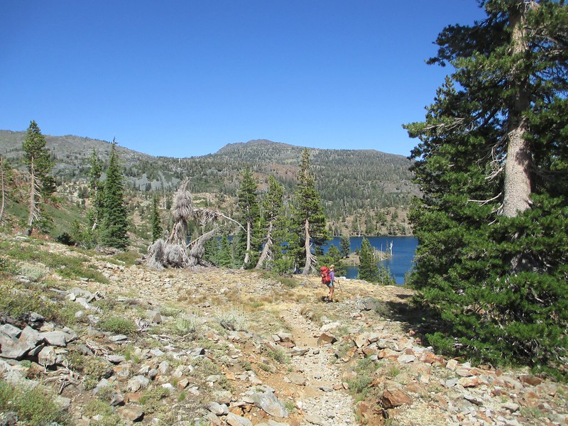
Very soon we were above the Echo Lakes, closing in on Aloha Lake:


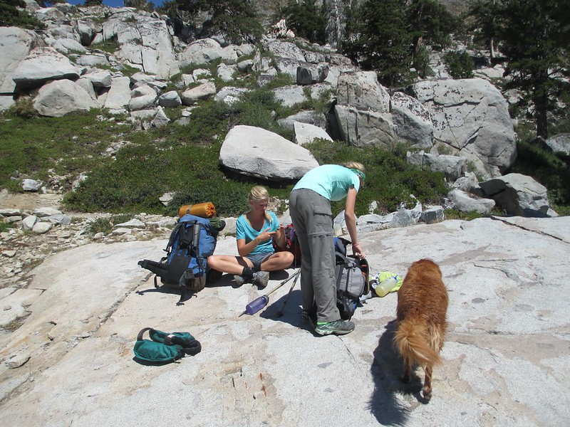
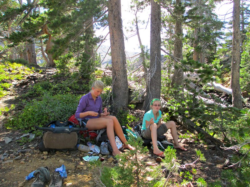
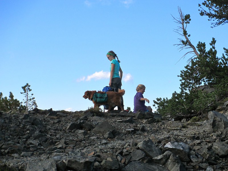
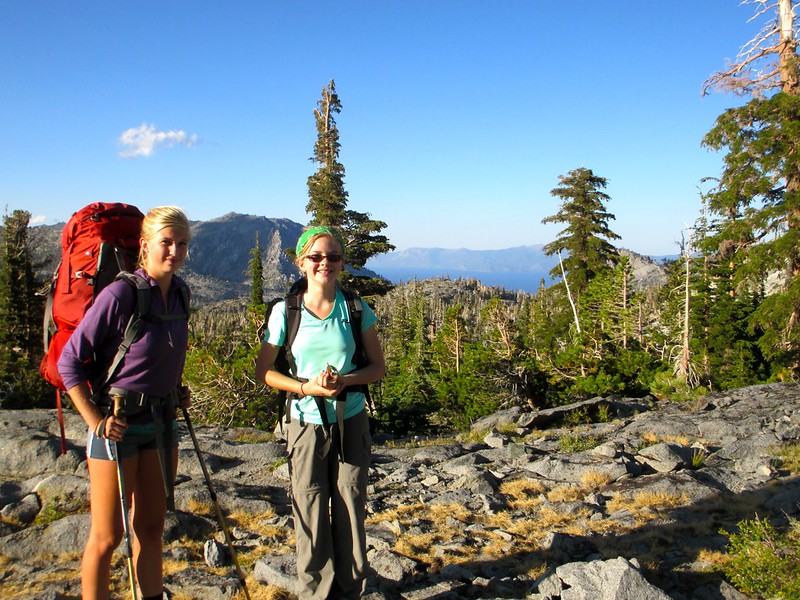
Fuel (in the form of food) is critical to keeping these two going, so we take frequent short breaks to stuff it down:


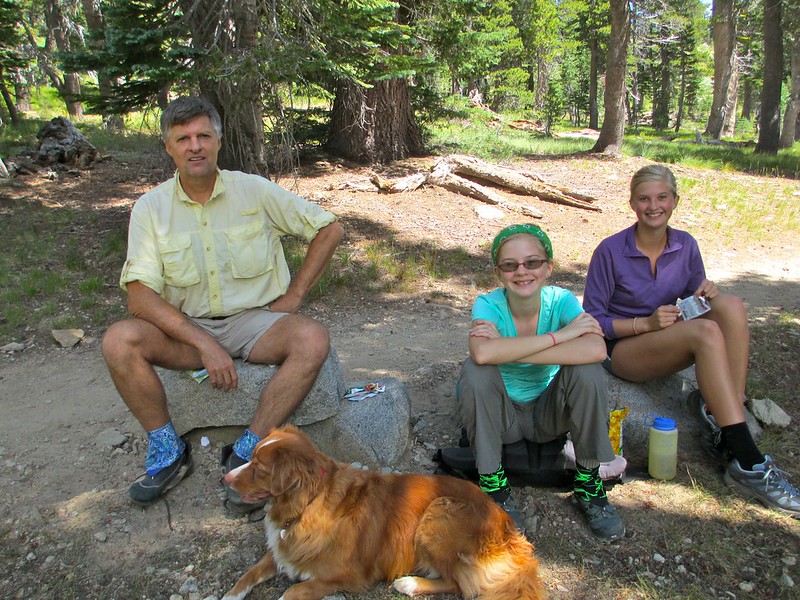
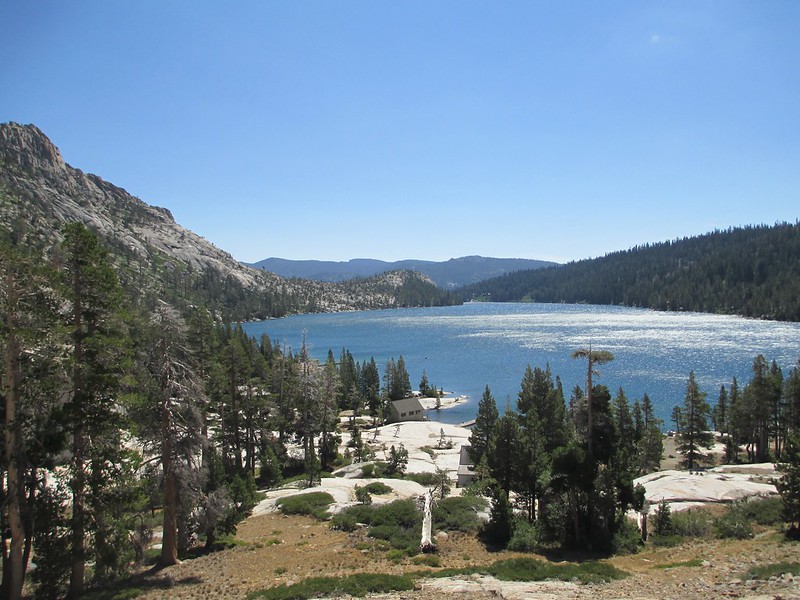
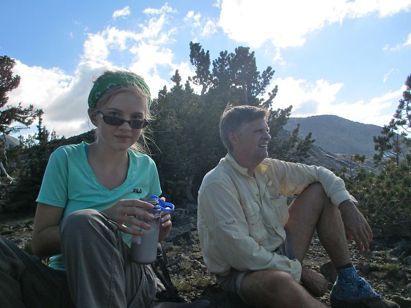
We approached Susie Lake and decided to have lunch there at 9.3 miles from our start:


At lunch we talked about where to go for the day. The two choices were Gilmore or Dicks Lake. These were about 4 1/2 miles apart and they are separated by Dicks Pass. While this pass wouldn't be a big one in the southern Sierra, here it was big enough and late enough in the day that it would take some real grunting to get over it. But if we didn't do it today, we'd have to do it tomorrow. Big first day or big second day?

The decision actually turned out to be easy: Katie thought we should make it the 15.2 miles to Dicks Lake and then have two more-cruiser days afterward. Tricia immediately agreed.

While at lunch we also found out that Katie was getting blisters. In fact, she was also very tired and took a 15 minute nap. As both issues came to light I started to realize some of the incredible amount of good Katie has realized from just her first year at college. She had brand new shoes and hadn't done any training hikes with them before this trip, and so her feet were suffering. But she didn't complain, she just kept on walking. She'd gotten only a few hours of sleep before we started (she was traveling up here) and yet she hiked onward (and suggested the longest possible distance for the day).

Katie has become pretty heavily involved with U.C.S.B.'s "Excursion Club." Actually she's been more than heavily involved: as a freshman they made her a club leader. She's been leading hiking, sea kayaking, stand up paddle-board and backpacking trips for other, less experienced kids. And man has it toughened her up (mind you, she was fairly tough to start with). Nothing seemed to faze her, no complaints.

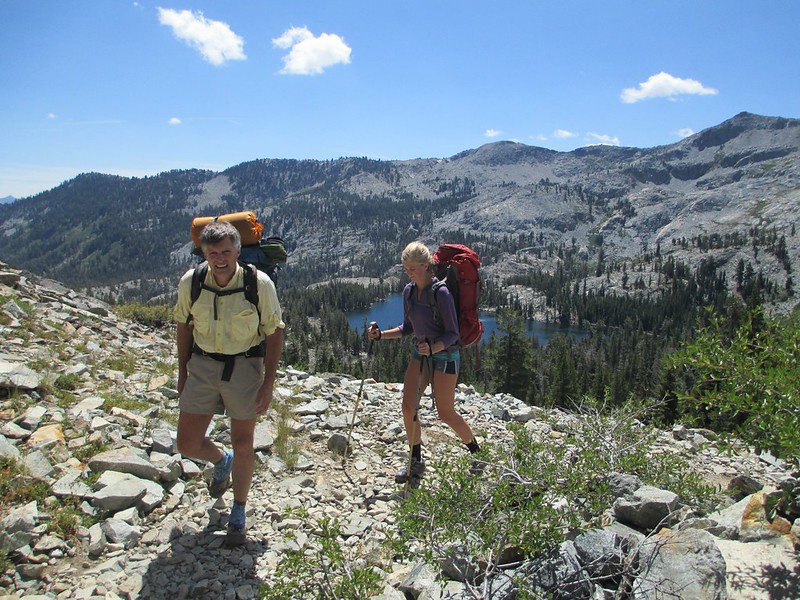
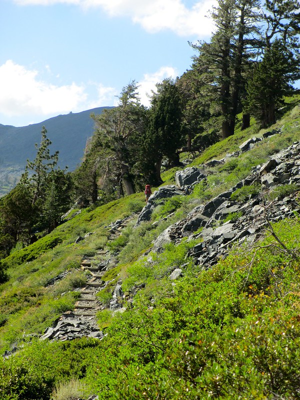
We started up Dicks Pass:


This geographic feature actually includes a "false" pass and the real pass. The false pass has the views, so we stopped there for trail milkshakes:


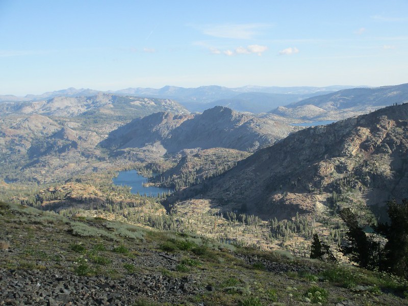
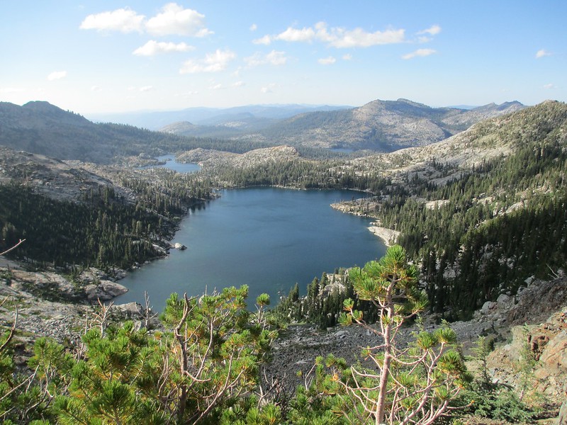
The views from here really were phenomenal. We could see our lunch spot at Susie Lake below (and Aloha Lake to the right of that):


We could see our day's destination, Dicks Lake:


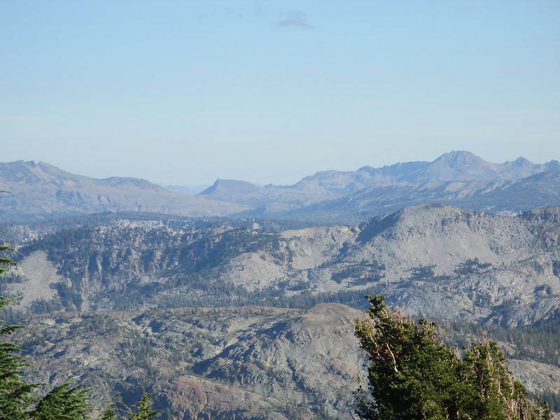
And Tricia and I were thrilled to see Elephant's Back and Round Top from here. These feature (which she clearly recognized and described to me) are south of Carson Pass - we had hiked past them two full hiking days ago! They must have been at least 25 miles from us, and yet we could see them clearly. This telephoto shot shows Elephant's Back (which the PCT traverses) right in the middle. It's left side is steep and shaded, the right side is lower angle and curved (the larger Round Top is to its right):


The "real" Dicks Pass was pretty if a little plain (but it also provided great views):


Our last two miles down to the lake were one of the best parts of this wonderful day. Tricia blazed ahead on the trail (talk about a tough and together kid!), while Katie and I went a little more slowly. As we hiked she talked and I mostly listened. And as I listened, I realized even more how good for her this first year of college has been.

When we arrived at the last trail junction before Dicks Lake we got our first view of Lake Tahoe from the Desolation Wilderness:


And then we got to camp (Dicks Lake was crowded with campers - but a group of Tahoe Rim Trail hikers kindly showed us a flat and pleasant place to set up for the night). I went for water while Katie and Tricia started setting up camp. This is a normal routine - and for their part they usually start with the tent. But when I came back from the lake the tent wasn't set up. Instead the girls were "stretching" using the new acro-yoga methods that Katie has gotten into down at U.C.S.B.:


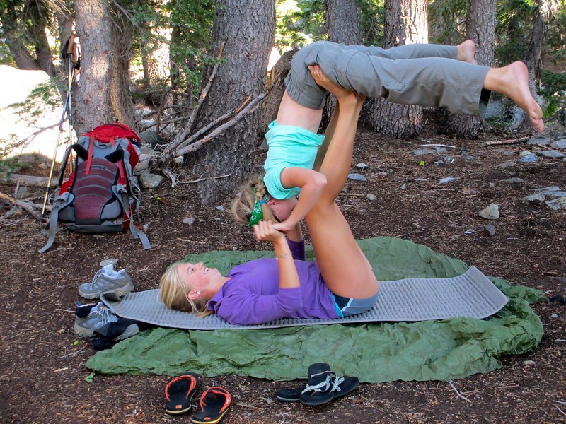
I may have strained some face muscles myself on this one. Not so much from the exercises themselves, but from coming back to camp to hear my two girls laughing and giggling together once again. I had a pretty damn big series of smiles.

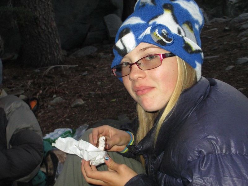
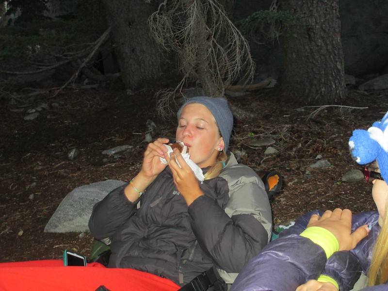
The night was already late, so we ate quickly and then got ready for bed. But just before bed we had one more treat for the evening. Although we often have freeze dried ice cream for dessert, Vicki had found freeze dried ice cream sandwiches for us to try this time. Our take away? We gotta get more of these things! They are quite the treat when the overall food picture isn't up to high epicurean standards!:


mynameismud

  • unworthy
  • Posts: 5974
    • Mudncrud
Re: The PCT Volume 23: The More the Merrier
« Reply #12 on: August 18, 2014, 08:07:45 AM »
really nice views.

I am sorry, perhaps it the pictures, Katie does not look old enough to be at a University.
Here's to sweat in your eye

Brad Young

  • Grand Master
  • ***
  • Posts: 6683
Re: The PCT Volume 23: The More the Merrier
« Reply #13 on: August 18, 2014, 05:58:18 PM »

I am sorry, perhaps it the pictures, Katie does not look old enough to be at a University.


That only seems to be the case. You've known her since she was in diapers - your old and unbending mind can't grasp the amount of change (sounds a bit like my mind...)  ;)

Brad Young

  • Grand Master
  • ***
  • Posts: 6683
Re: The PCT Volume 23: The More the Merrier
« Reply #14 on: August 18, 2014, 06:32:47 PM »
I let the girls sleep as long as they wanted on Friday morning (Katie hadn't gotten much sleep the two previous nights). But then we got going on the day:


We started our hike passing between granite outcrops and various lakes. This was pretty country:


As with some of our other recent hikes, the walking today seemed unusually level (at least by Sierra Nevada standards). So we made very good time:


After just a few miles the trail entered forested areas. Areas like this are pretty, and while we enjoyed ourselves, this part of our journey didn't offer panoramas particularly, and it didn't offer much variety. The hike wasn't very long either - we'd decided to hike just under 11 miles to Richardson Lake, a location which would put us in perfect position to meet Vicki tomorrow. We did reach the nondescript, northern edge of the Desolation Wilderness:


We got a glimpse or two of Lake Tahoe through the trees:


And then, quickly, we reached Richardson Lake:


Like Dicks Lake the night before, this one was crowded with campers. But as with the night before at Dicks, everyone was friendly here too. We had time to set up camp, explore the lake shore, and to play and relax:


And note the iPhone in Katie's hand two photos above? I've trained the girls that "electronics" (like music and telephones) aren't part of the wilderness experience. Katie told me - before she put it in her pack - that she was bringing it because it is her camera. Apparently she also makes notes on it to herself. In the particular photo above, that's what she's doing - she is making a note about backpacking gear of her own that she'd been discussing with me and which she needs/wants to get.

Dinner and the usual evening chores then ended a relatively non-eventful day, another we had been lucky enough to spend in peace, health and nature's beauty.

mynameismud

  • unworthy
  • Posts: 5974
    • Mudncrud
Re: The PCT Volume 23: The More the Merrier
« Reply #15 on: August 18, 2014, 07:10:41 PM »
That only seems to be the case. You've known her since she was in diapers - your old and unbending mind can't grasp the amount of change (sounds a bit like my mind...)  ;)

cannot argue this.
Here's to sweat in your eye

mungeclimber

  • PermaBan
  • ***
  • Posts: 6665
    • http://www.sonorapassclimbing.com
Re: The PCT Volume 23: The More the Merrier
« Reply #16 on: August 19, 2014, 11:05:44 AM »
that dog is water logged. heh

Sounds like Katie's knees aren't bothering her this trip since you're making good time.  The terrain a little better compared to the up and down of the previous trips?
On Aid at Pinns... It's all A1 til it crumbles. - Munge

Brad Young

  • Grand Master
  • ***
  • Posts: 6683
Re: The PCT Volume 23: The More the Merrier
« Reply #17 on: August 19, 2014, 12:00:21 PM »

that dog is water logged. heh

Careful, comments like that tend to "stick" in ones throat…

Quote
Sounds like Katie's knees aren't bothering her this trip since you're making good time.  The terrain a little better compared to the up and down of the previous trips?

No issues with the knees at all. And yeah, much gentler terrain; none of the half-a-day-up and then half-a-day-down passes of the southern Sierra.

Issues with Flickr though - the last day's photos were still downloading this morning when I left home (or maybe it's just our rural bandwidth?).

mungeclimber

  • PermaBan
  • ***
  • Posts: 6665
    • http://www.sonorapassclimbing.com
Re: The PCT Volume 23: The More the Merrier
« Reply #18 on: August 19, 2014, 02:07:23 PM »
speedtest.net

check your numbers over a couple of days and compare to what they advertise your rate to be.

Also, couldn't hurt to clear cache or if using the Flickr app to upload, reinstall the app.
On Aid at Pinns... It's all A1 til it crumbles. - Munge

Brad Young

  • Grand Master
  • ***
  • Posts: 6683
Re: The PCT Volume 23: The More the Merrier
« Reply #19 on: August 19, 2014, 06:10:52 PM »
I'm not sure any of that is the problem. It's pure lack of bandwidth (I think Steve would confirm that). We've had the company tell us that we "don't yet have" DSL up here, only dial-up. When Vicki insists that we don't use dial-up and we've got DSL, the lady actually said: "well don't tell anyone"

Maybe it's a cost of living in so nice a place?