My outing with clink got cancelled this morning so I am left to overshare with you crudders.
Kat and I went back out to Tugboat yesterday with the hope of bagging the summit. I read every description in every guidebook. They all say to start on the same side (the left side) which we knew was impossible, since we scouted the formation back in 2013 and discovered an unlikely, loose, filthy start completely choked with PO. It was time to take another look. I looked on Google Earth and the right side of the formation looked clear. I also referred to Bruce’s rebolting post from 2012 for additional clues. I remembered Bruce telling me that Clint led a face (about 50 feet of 5.2) to get on deck. I also remembered Bruce saying the upper groove was scary. I was determined to get up this thing. It looks so cool from a distance and it is one of the oldest routes in the park. Roper speculated the FA was 1962 and Richards (the old guide I like the most) said 1956. Richards describes the upper groove as sinister looking.

We found our way up the hillside, managing to avoid just a few leafless sprigs of PO down low. The hillside is clear but particularly annoying in terms of steepness, looseness (lots of scree and dirt) and groundcover that fills your socks and boots with hitchhikers. The right side is sunny this time of year so we had no time to waste (a predicted high of 88 turned out to be 90 when we checked later).
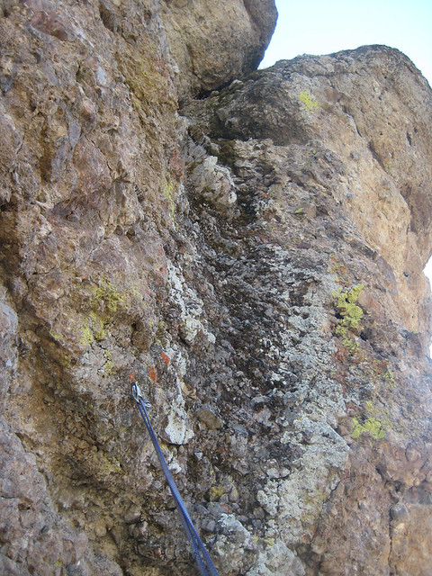
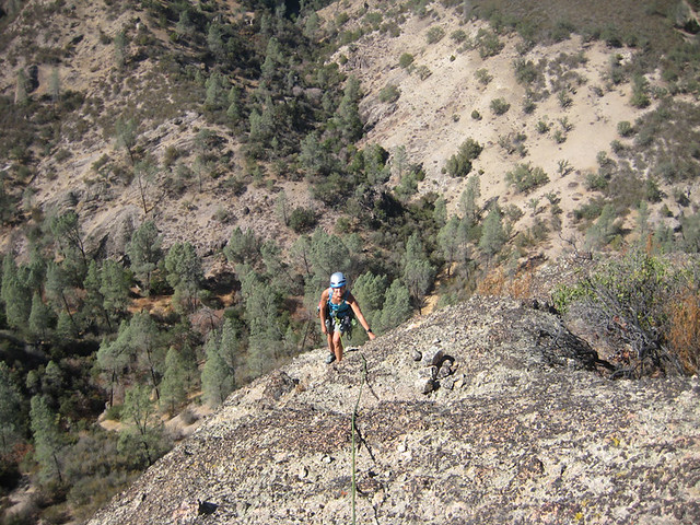
I found what looked like a reasonable start and stepped on. It was relatively easy but awkward right at the start. The sloping nature of the multiple decks and all the loose material on the surface makes you immediately aware of disastrous consequences and of course no meaningful pro – not to mention the length of time a rescue would take out there. Its Pinnacles – get over it.
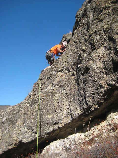
Up and up I went, at times feeling like I was hiking up loose gravel and wishing I didn’t have climbing shoes on.
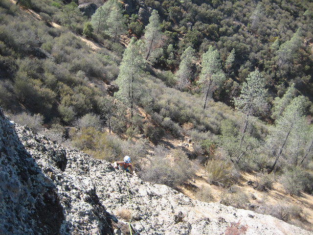
I stopped and looked back down to Kat just before I went out of sight - probably still 40 feet from the belay. I’d estimate the first pitch at 95 feet (kind of reminded me of Ball Pinnacle).
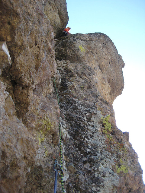
I looked up to see evidence of the last party bailing off.
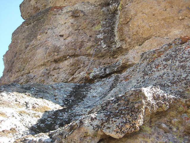
When I got to the belay I realized that the belay bolt Bruce describes can actually be paired with the first lead bolt for a 2 bolt belay. The 2 bolts are only about 6 feet apart. The belay bolt is on the flat ledge and the first lead bolt is very low on the wall above.
http://www.mudncrud.com/forums/index.php?topic=1587.msg19192;topicseen#msg19192Why did that party bail? No guidebook mentions more than 2 bolts. The 2nd lead bolt cannot be seen from below. Maybe they got up there, saw the two bolts and thought - no way I’m climbing up this thing unprotected. I think the other thing that happens at Pinns is people go looking for a climb strictly based on the grade. I talked to a kid one day that casually said he was going to do Knifeblade...

I belayed Kat up through the kitty litter nonsense and got set up to lead pitch 2.
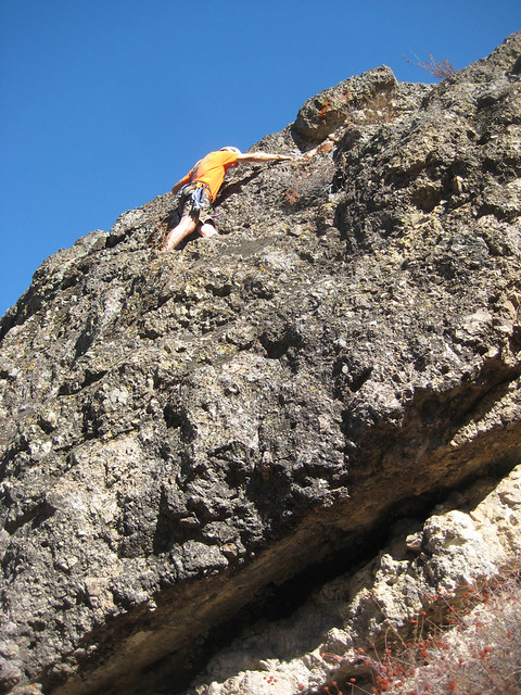
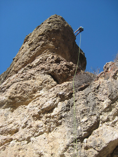
This is when you realize that the first lead bolt is way too low and way too far left – did they aid the start? (it was late 50’s or early 60’s). Aiding doesn't seem likely since the bolt is so far left but latch onto the starting holds and step into it and it is game on for a long series of steep, thin moves. There is a big lodestone above that looks like a thank God hold(it's not) as you claw your way through the 5.6(not) crux. Sling a knob and move up to the 2nd bolt – which also seems to be in a weird location (too low). There are a couple potential big cam placements (2 to 4 inches?) above bolt 2 but the climbing has eased considerably and you’re not that far from the bolt. Exposed moves on good rock get you to the top of the chute where you can sling a bomber knob for the exit moves.
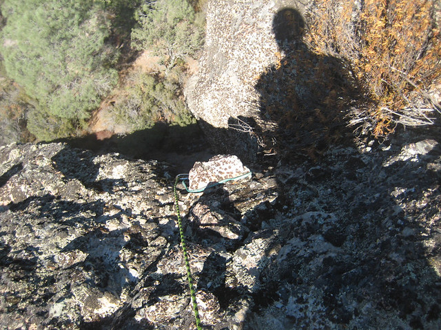
Looking down from the cozy slot above bolt 2
Bomber sling knob for the exit moves
The bolts really don’t protect the hardest moves other than to keep you from going all the way (another possible indicator of aiding?). Another old, no-fall Pinnacles route – shocking!


It’s old school cool.
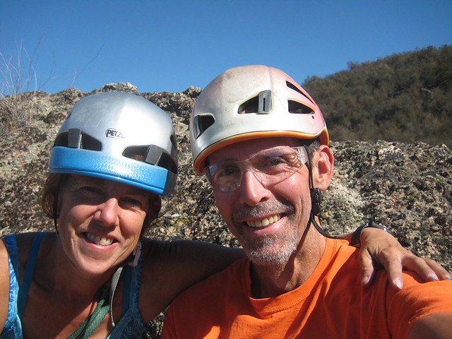
Kat followed and we got down as quickly as we could (it was hot).
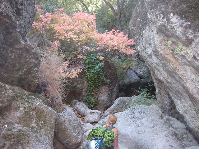
Now slide, slip and cuss your way back to staging in climbing shoes. Pack up and ski scree back to the shade. We snacked, hydrated and then enjoyed some autumn leaves(PO of course) on our way into the wonderful coolness of the caves.
We stopped by the Chalone winery on our way out for tasting and our thrice yearly member pickup.
Here is a photo topo and an updated but wordy description for the climb.
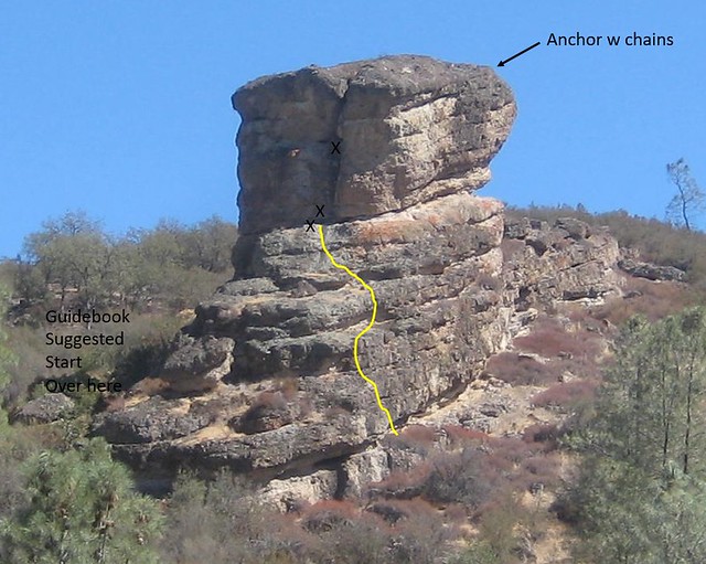
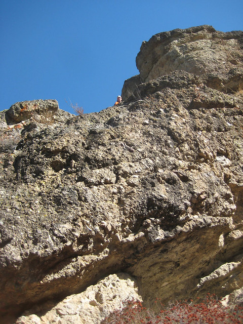
Tugboat 5.7
Approach – weave up through relatively clear areas shortly after the formation comes into view from the Old Pinnacles trail (a short distance past/north of the junction of the Balconies Cliff trail and Old Pinnacles trail).
Start climbing (3rd or 4th class) up the southwest side from a plant-covered ledge about 50 feet uphill from the toe (see photo topo). Surmount multiple “decks” to reach a belay 95 feet from the start. A bolt at your feet and one low on the wall above (the first lead bolt) provide a belay and protection for starting pitch 2. Climb up the steep chute to a second bolt (cannot be seen from below) that protects the easier, upper section of the chute. Medium to large cams (2 to 4 inches) can be used to supplement the 2nd bolt. A large sling knob protects the exit moves. Scramble another 40 feet to the anchor on the backside lip of the formation (cannot be seen from below). Rappel 85 feet to the ground. There is currently no poison oak on this side of the formation.


