Author Topic: Middle Fork Area Take Two  (Read 21541 times)

clink

  • Meanderthal
  • ****
  • Posts: 4119
Re: Middle Fork Area Take Two
« Reply #20 on: July 11, 2018, 04:34:55 PM »

 If we knew where everyone was located it would be only Rescue instead of Search And Rescue. Where is the fun in that?
Causing trouble when not climbing.

F4?

  • unworthy
  • Posts: 6176
Re: Middle Fork Area Take Two
« Reply #21 on: July 11, 2018, 05:37:57 PM »
True, but he I so skinny, they'd never find him.

Plus I want to watch him on my iPhone...going, going, slowing, slowing, after 5min no moving.....Send text>>wake up!

Not intrusive at all.
I'm not worthy.

mynameismud

  • unworthy
  • Posts: 5991
    • Mudncrud
Re: Middle Fork Area Take Two
« Reply #22 on: July 11, 2018, 09:55:49 PM »
yeah, maybe sharing is not such a good idea
Here's to sweat in your eye

mynameismud

  • unworthy
  • Posts: 5991
    • Mudncrud
Re: Middle Fork Area Take Two
« Reply #23 on: July 15, 2018, 08:46:57 AM »
I have some additional pics, I can see them on my phone but when I open the folder for my phone I do not see them.  When I figure out how to get them off my phone I will post them.

Below is the drainage that Buddy and I hiked out a couple of weeks ago.


Approach is along the ridge.  Garfield is in the background.


The summit of Quarts Peak.  I want to do the slab, seems fairly casual if perhaps a bit dirty.  It is mostly a ridge run to the summit.  At the very end I dropped down the backside since I was not up for the solo to the summit 5.9/5.10 slab or exposed 5.7.


Not much here really.  There are some good slabs but mostly just to slabby.


lots and lots of this.  Basically just grab a handful and pull your self through.  Makes even easy terrain slow.  It helps with the steeper stuff since you can pull yourself up.


Nice View

Here's to sweat in your eye

clink

  • Meanderthal
  • ****
  • Posts: 4119
Re: Middle Fork Area Take Two
« Reply #24 on: July 15, 2018, 08:52:03 AM »
Beauty country!
Causing trouble when not climbing.

F4?

  • unworthy
  • Posts: 6176
Re: Middle Fork Area Take Two
« Reply #25 on: July 15, 2018, 10:27:17 AM »
Nice!

We can grid bolt!
I'm not worthy.

mynameismud

  • unworthy
  • Posts: 5991
    • Mudncrud
Re: Middle Fork Area Take Two
« Reply #26 on: July 15, 2018, 12:58:15 PM »
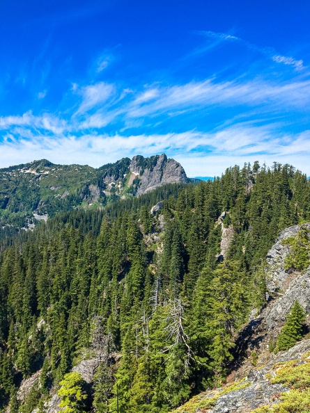
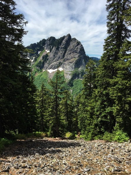
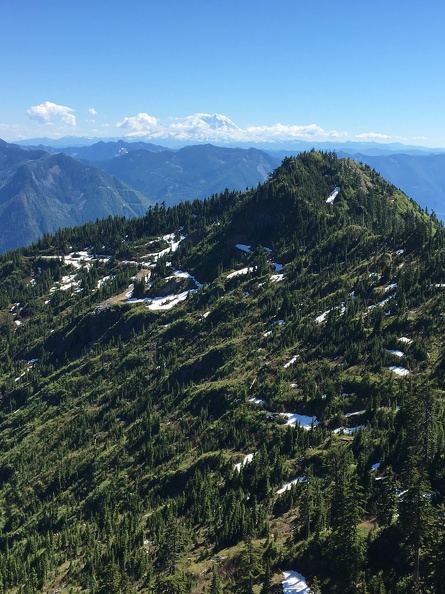
Much later in the hike I ended up finding a road.  At this point in the hike I did not know it was there.  The road is below the summit on the far left of the pic.  It is right below the small snow field.  The peak in the center is Bessemer.  I did not have time to summit.


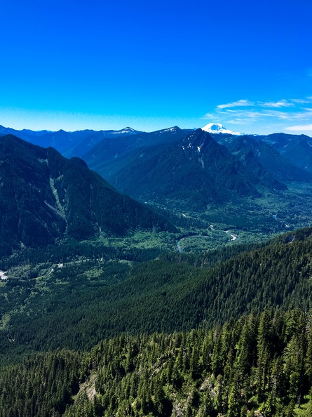
This was my first good view of the Mountain


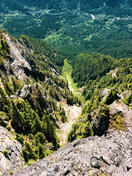
This is the drainage I wanted to get a look at.  Unfortunately I still do not know exactly where to come in from to enter this drainage but I have a much better idea.  Seems to have some good rock potential.


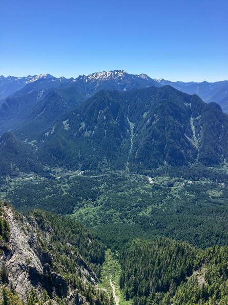
Higher in that drainage, Mnt Garfield, Cascades, Middle Fork


Whoop, There it is!


View to the other side


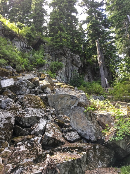
This was a cool spot.  Walk into the middle of the clump of trees and look straight down to talus
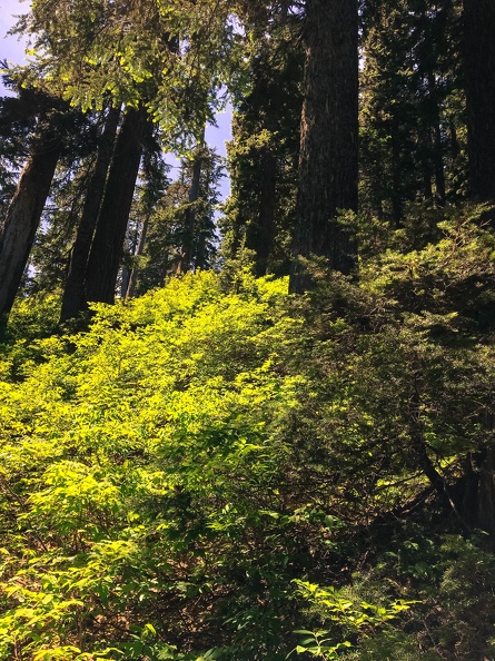
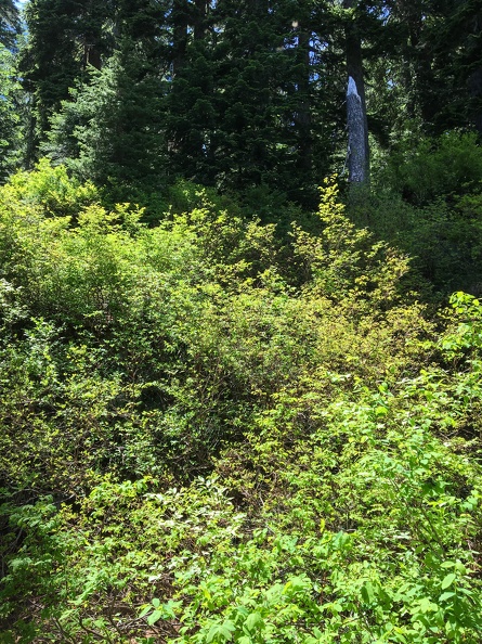

More bushwhacking


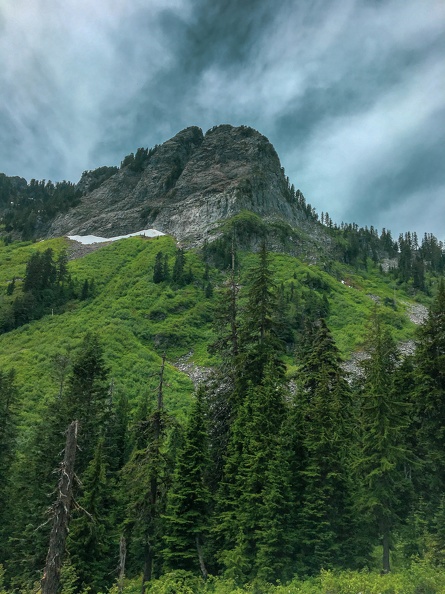
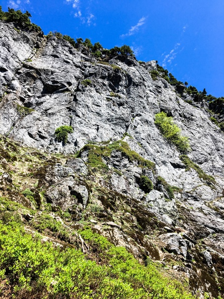
Mnt Bessemer, was not sure once I got there if I should go left or right.  I ended up going around the right side but I am now fairly sure there is an approach up a gully.


I ended up hiking up and right following the talus field.  I got some real nice wind there.  Enough wind that if I did not sit down it kept all the bugs away.  So I stood there and ate some lunch.


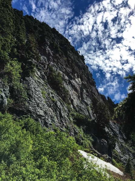
Cool spot, but I went left.


Which led to more of this.


Back side of Bessemer and more bushwhacking.  I went above the snow field.


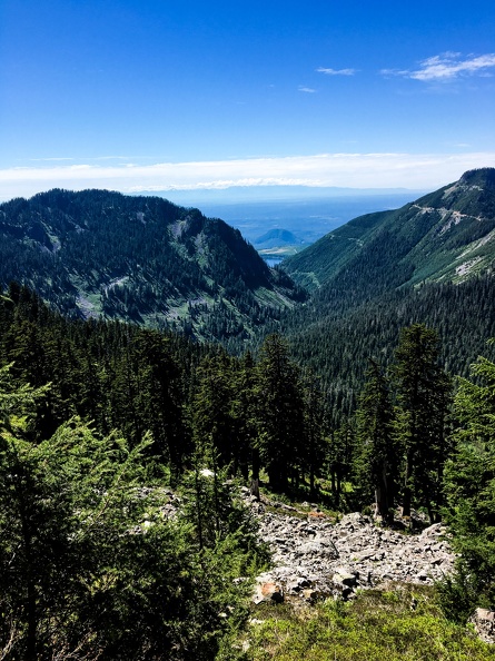
View of the Olympics and the lake is toward my place.


Back side of Bessemer.  No published routes.  The center line actually looks OK for those that like wider stuff.


This is where I saw the road.  I figured it would take 20 minutes or so since it is not that far.  It took a fair bit longer.  Lots of brush and some creeks.  This is also where I got stung.  I grabbed a bush to pull myself along then heard a loud buzz followed by a zing.  
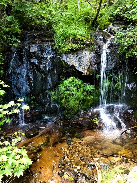

Cool little fall.


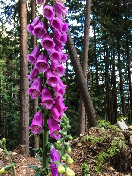
Obligatory flower shot.


The CCC road and the last few miles out.  Was happy to get here, the road came out much further down river than I thought I would.


Mostly this hike was not too exciting although it was taxing.  There were a few moments climbing up stuff.  At one point climbing up the gully behind Bessemer where I was 50 feet up or so and had pulled up on the loose block and was holding onto to creaky root where I just had to go up cuz I really did not want to reverse the last couple of moves.  So I did a good under cling on the root, reached high and buried my right hand up to the wrist in duff, high stepped over a root and mantled up onto the slope above where I dead pointed to a tree.   I think that was a C1 move (Cascade 1).  Another time I jumped off of a ledge to a slope and my feet cut loose but I easily grabbed a bush and came to a stop right away which was my plan B. C0 (Cascade 0).

I did find quite a bit of good rock and some real good potential.  Some of it requires a bit of an approach.  I am happy to know what is in drainage number two.  I think I can piece this together into a 5 summit day.  Felt good since I did not have a map and just did dead reckoning.  I had looked at a topo on Google a couple of days before so I knew more or less where stuff was.  Felt real good to basically hike to the top of BeseQuartz.  It is buried in the trees easy to see from up high but down low in the trees it disappears.  I had to skirt around to the right but manage to pop up 30 feet from the top.

The road was a great find.  I now know I can hike up Bessemer Road (who would have thought) almost right to the top of summit 4026 then to Bessemer South.

It took me a while to get to the road and once on it I was pondering if it was worth it because even though it was going down it seemed to be trending away from the Middle Fork.  I was going to go just a bit further before deciding which ridge to drop down.  In general the ridges seem better since they have trees and when there are a lot of big trees there is not as much under growth.  Anyway I was looking up the road trying to figure out where everything was going when I noticed a white helmet.  It was a serious shock, I mean what the heck was a Mnt Biker doing up here?  I waved and thankfully he road my way.  perhaps he was thinking the same.  As soon as he rolled over I asked if the road went down to the river, no intros no nothing.  Just does this go down to the river which he replied yes and proceeded to show me his track on his phone.  Then we talked, and finally he came around to "where did you come from".  When I explained he just looked puzzled and after a bit said he would look at a map.

The road to the CCC trail was a fair bit longer than dropping down a ridge but they were easy miles and there was no bushwhacking.  I turned on the headlamp for the last 30 minutes but probably could have done it without.  This was the first hike, climb whatever that I packed for the night before in quite some time.  Even with that I managed to leave out the water filter.
Here's to sweat in your eye

F4?

  • unworthy
  • Posts: 6176
Re: Middle Fork Area Take Two
« Reply #27 on: July 15, 2018, 01:17:54 PM »
 :thumbup:
I'm not worthy.

mudworm

  • Head Mistress
  • *
  • Posts: 1738
    • http://www.mxi2000.net
Re: Middle Fork Area Take Two
« Reply #28 on: July 15, 2018, 08:05:18 PM »
I have some additional pics, I can see them on my phone but when I open the folder for my phone I do not see them.  When I figure out how to get them off my phone I will post them.
Ask Buddy.

Inch by inch, I will get there.

mynameismud

  • unworthy
  • Posts: 5991
    • Mudncrud
Re: Middle Fork Area Take Two
« Reply #29 on: July 15, 2018, 08:37:20 PM »
Ask Buddy.

He is incredibly helpful
Here's to sweat in your eye

Brad Young

  • Grand Master
  • ***
  • Posts: 6861
Re: Middle Fork Area Take Two
« Reply #30 on: July 16, 2018, 05:24:04 AM »
I swear I posted this last night, but I was very tired and may have shut down without hitting "post."

I'd be curious to hear your comparison of moving cross-country in that steep, steep Washington terrain, thick with brush and trees, and cross-country movement in Pinnacles' chaparral in the heat.

Now keep in mind that you're crazy for doing either too.

Brad Young

  • Grand Master
  • ***
  • Posts: 6861
Re: Middle Fork Area Take Two
« Reply #31 on: July 16, 2018, 05:28:03 AM »
^^^

That Washington stuff looks way worse to me. I never lets up (until you find a road ;)). And the bugs.

mynameismud

  • unworthy
  • Posts: 5991
    • Mudncrud
Re: Middle Fork Area Take Two
« Reply #32 on: July 16, 2018, 06:06:41 AM »
I have done a bit of bushwhacking in the Pins.  This seems worse.  The Pins it seems there are breaks where you can get around and through.  There are definitely areas at the Pins where stuff seems impenetrable but in my experience they are short.  This stuff can be just as thick and even though there is no buck brush there are devils club and brambles.  This stuff just does not end, it goes on for miles.

In looking at trip reports to these peaks they were all in the winter or early spring.  I wondered, why only winter ascents?  Now I know most people are only willing to ski over this stuff.  The upside is it seems I have these hills mostly to myself.
Here's to sweat in your eye

mudworm

  • Head Mistress
  • *
  • Posts: 1738
    • http://www.mxi2000.net
Re: Middle Fork Area Take Two
« Reply #33 on: July 16, 2018, 08:27:12 AM »
But no PO in Washington, right? Pinns... another story.
Inch by inch, I will get there.

Brad Young

  • Grand Master
  • ***
  • Posts: 6861
Re: Middle Fork Area Take Two
« Reply #34 on: July 16, 2018, 08:47:05 AM »

But no PO in Washington, right? Pinns... another story.


There's gotta be P.O. in Washington. But maybe not up at that elevation?

How about ticks? Ticks would keep Munge away (although I doubt he's urgent to crash through that stuff anyway).

mungeclimber

  • PermaBan
  • ***
  • Posts: 6722
    • http://www.sonorapassclimbing.com
Re: Middle Fork Area Take Two
« Reply #35 on: July 16, 2018, 02:09:36 PM »
I'm planning my visits based on the number of pics that show a trail has been established and many bolts installed. ;)
On Aid at Pinns... It's all A1 til it crumbles. - Munge

mynameismud

  • unworthy
  • Posts: 5991
    • Mudncrud
Re: Middle Fork Area Take Two
« Reply #36 on: July 16, 2018, 04:43:18 PM »
There are ticks but I have yet to encounter them.  Not a lot of P.O. so that is a big advantage, but there is Poison Sumac.  After the last hike I ended up with a rash on my back where the bottom of by pack  sits.  Not sure what caused it.

Here's to sweat in your eye

JC w KC redux

  • Agent Orange
  • ****
  • Posts: 6634
  • my density has brought me to you...
Re: Middle Fork Area Take Two
« Reply #37 on: July 16, 2018, 05:44:13 PM »

That looks like some rugged and very cool terrain.
Nice back yard  :thumbup: :yesnod: :biggrin:
One wheel shy of "normal"

Brad Young

  • Grand Master
  • ***
  • Posts: 6861
Re: Middle Fork Area Take Two
« Reply #38 on: July 16, 2018, 05:47:40 PM »

...I ended up with a rash on my back where the bottom of by pack  sits.


There are so many things that could be said in response to this. Clink would throw them right out there. I'll be a little more polite.  ;D

F4?

  • unworthy
  • Posts: 6176
Re: Middle Fork Area Take Two
« Reply #39 on: July 16, 2018, 08:43:01 PM »

Quote
Insert Quote
I'm planning my visits based on the number of pics that show a trail has been established and many bolts installed.

Munge, we can grid bolt it. You take the right side and I'll take the left. Routes spaced 10ft apart.

Mr Mud just needs to cut a bermed trail to the crag for us..
I'm not worthy.